| �g�b�v > |
�V���̃y�[�W |

�R�c�n���V�\�t�g�uNASA World Wind�v�̎g����
| �����y�[�W�̍X�V�́u�V���̃y�[�W�v�X�V�������Q�Ƃ��������B | |||
| �@ | |||
| NASA World Wind�́ANASA�i�čq��F���ǁj���J�������R�c�n���V�\�t�g �@�E��p�\�t�g���g���āANASA��TerraServer-USA ��Web�Ō��J���Ă���f�[�^�� �@�@�X�g���[�~���O��M���Ȃ���q���ʐ^��q��ʐ^��\�����邱�Ƃ��ł���B �@�E�ގ���Google Earth�Ɣ�ׂ�Ɠ��{�����̉q���ʐ^�̉𑜓x�͗�����B �@�E�č����̓s�s���́A���m�N���ł͂��邪�ڍׂȍq��ʐ^��\���ł���B �@�E�q���ʐ^�̉摜�ɋC�ۃf�[�^�i�_�̏�Ԃ�~�J�ʁj���d�ˍ��킹�ĕ\���ł���B |
|||
| 2007�N2��14���@Ver1.4�������[�X���ꂽ�B �傫�ȋ@�\�lj��Ƃ��ẮA���z�̓������V�~�����[�g�\������ƂƂ��ɁA���z�����ɂ��e��\���ł���悤�ɂȂ����B |
|||
| �@ | |||
| ������ɂ� �uMicrosoft .NET Framework�v�ƁuMicrosoft DirectX�v ���K�v�ł���B �@�V�X�e���v���X�y�b�N�͈ȉ��̂Ƃ��� �@�@�EOS�FWindows 2000, XP �@�@�ECPU�F1GHz�ȏ� �@�@�E�V�X�e��������(RAM)�F256MB �@�@�E�n�[�h�f�B�X�N�F3GB �̋X�y�[�X �@�@�E�R�c�O���t�B�b�N�X�J�[�h�F������̃y�[�W���Q���@�g�p���Ă��鐻�i���ɂn�j�̕\��������Ζ��Ȃ� �@�@�E�l�b�g���[�N�F�C���^�[�l�b�g�ɐڑ��ł��邱�� ��Windows Vista �� Windows7 �ł̗��p �@���o�[�W����1.4�����[�X�m�[�g�ɂ��AWindows Vista�ł����삷�邪��肪����ƋL�ڂ���Ă���B �@�C���X�g�[��������юg�p����ۂ�UAC(���[�U�[�A�J�E���g����)�@�\���ꎞ�I�ɖ����ɂ��Ȃ���Ȃ�Ȃ��ƁB �@�V���[�g�J�b�g�̌݊����^�u�œ������x�����u�Ǘ��҂Ƃ��Ă��̃v���O���������s����v�Ƀ`�F�b�N����悢�B �@Windows7�̏ꍇ�AMicrosoft .NET Framework��.NET Framework 3.5���f�B�t�H���g�œ�������Ă���̂� �@�C���X�g�[���s�v ���_�E�����[�h�͂����炩���@  �_�E�����[�h�T�C�Y�F16MB�@�i�o�[�W����1.4�j |
| �@ | |
| �@�@�N�����̃X�v���b�V����ʂ̌�ŁA���̂悤�ȏ�����ʂ��\�������B | |
�@�@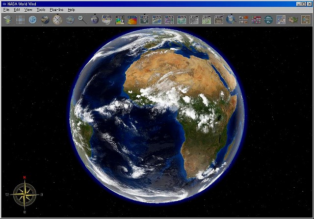 |
|
| �@ |
| �@�P�j��{���� | |
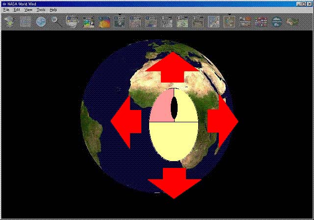
| �@�@�n������]������F�}�E�X�̍��{�^������������Ԃňړ������� | |
�@�@ |
|
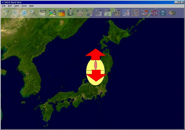
| �@�A�Y�[���C���i�g��j�E�Y�[���A�E�g�i�L��j�F�}�E�X�̃z�C�[������]������ | |
�@�@ |
|
| �@�B���Պp�x��ύX����F�}�E�X�̉E�{�^������������Ԃŏ㉺�����Ɉړ������� | |
�@�@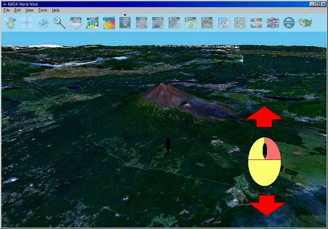 |
|
| �@�C��]������F�}�E�X�̉E�{�^������������ԂŎ��_���ڂ����������ֈړ������� | |
�@�@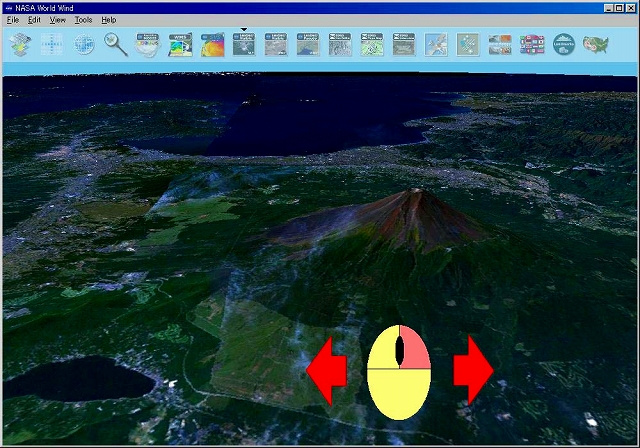 |
|
| �@�@����̇@����C�̐}�̓o�[�W����1.3.1�̃X�N���[���V���b�g���g�p���Ă��܂��B | |
| �@ | |
| �@�Q�j�l������ | |
| �@�@�@[File] - [Save Screenshoot] | |
| �\������Ă���摜��ۑ�����B | |
| �@�@�@[View] - [Vertical Exaggeration] | |
| �R�c�\���̔{���i1.0�� ���� 10.0���܂Łj���w�肷��B���l���傫���قǕW���ɂ�鍷����������ĎR���낪���Č�����B | |
| �L�[�{�[�h�̐������͂ł��w��i�P����X�܂Ł@�O�Ń��Z�b�g�j | |
| �@�@�@[View] - [Reset Default View] | |
| ���ʁi�k����Ɂj����ј��Պp�x�i�^�ォ��̎��_�Ɂj�����Z�b�g����B | |
| �@ | |
| �@�R�j�c�[���o�[�̕\���� | |
| �@�o�[�W����1.3.5 | |
| ���@�kayer Manager | |
| �q���摜�⑼�̃f�[�^�Ƃ̏d�ˍ��킹�\�����R���g���[������B �iImages�CBoudaries�CPlacenames�CAstrobiology Field Guide�CFlag of the World�CLandmark Catalog�CLewis and Clark Trail�Ȃǁj�Ń`�F�b�N�}�[�N��t�������̂��L���ƂȂ�B ���ꂼ��̃A�C�R���}�[�N�ł̃R���g���[���i�A�C�R�����N���b�N���ăA�C�R���̏�Ɂ����t���Ε\����ԁj���\�B |
|
| ���@Position Infomation | |
| �{�J�[�\���ʒu�̈ܓx�A�o�x�A���x����\������B | |
| ���@Latitude & Longitude Lines | |
| �ܓx����ьo�x��\������B | |
| ���@NASA Blue Marble | |
| �n���S�̂̃C���[�W��\������BBlue Marble Next-Generation��Plugin��ύX����G�߁i�����j�̉摜���m�F�ł���B | |
| ���@Compass | |
| �R���p�X��\������B | |
| ���@Naval Research Labs, - Real-time Weather | |
| ���݂̋C�ۃf�[�^�iNRL:Naval Research Laboratory�j���d�˕\������B�i�ԊO�Z���T�摜�A�~�J���x�j | |
| ���@Place Finder | |
| Look for place named:�Ɍ������n��(�Ⴆ��TOKYO)����͂���Search�{�^�����N���b�N���Č�����A�\�����ꂽ������ړI�̒n�於��I��Go�{�^�����N���b�N����ΊY���n�悪�\�������B | |
| ���@Glebal Clouds | |
| ���E�̉_�̏�Ԃ�\�� | |
| ���@Rapid Fire MODIS | |
| ��Ύ��A�^���A���A�ΎR�̕��Ȃǂ̍ЊQ�����������n���ɃA�C�R�����\�������B�A�C�R���Ƀ}�E�X�J�[�\�����d�˂�ƍЊQ�̓��e�Ɣ����������\�������B | |
| ���@WMS Brouser | |
| ���E�e�n�̋C���E�C���E�~���ʁE�~��ʁE�C�ʉ��x�Ȃǂ̍ō��l�A�Œ�l�A���ϒl�̂悤�ȗl�X�ȃf�[�^���v�����o�R�Ŏ擾���f�[�^�ɉ����Ēn���V��ɏd�˂ĕ\������B���Ԃ��w�肷��A�w�肵�����Ԃ̋C���̕ϓ��Ȃǂ�n���V��ŃA�j���[�V�����\�����\�B | |
| ���@Scientific Visualization Studio | |
| 2002�N�ɔ��������A�t���J�̉ЂȂǂ�n���V��ɏd�˂ăA�j���[�V�����\������B | |
| ���@NLT Landsat7(Visible Color) | |
| NASA LT(Learning Technologies)�ɂ��LANDSAT7�摜��\������B�i�𑜓x�F30m�@�J���[�j | |
| ���@Community Landsat7/NLT Landsat7(Pseudo Color) | |
| WWC/NASA LT�ɂ��LANDSAT7�摜��\������B(�𑜓x�F15m�@�[���J���[) | |
| ���@Geocover 2000 | |
| LANDSAT7�ɂ���� 2000�N���ɎB�e���ꂽGeoCover�摜�@�i�𑜓x�F14.25m�j ETM+(Enhanced Thematic Mapper)�f�[�^�ɂ��J���[�����@bands7�F��, bands4�F��, bands2�F�� �ŕ\�������B |
|
| ���@Geocover 1990 | |
| LANDSAT4/5�ɂ���� 1990�N���ɎB�e���ꂽGeoCover�摜 �i�𑜓x�F28.5m�j TM(Thematic Mapper)�f�[�^�ɂ��J���[�����@bands7�F��, bands4�F��, bands2�F�� �ŕ\�������B |
|
| ���@USGS Digital Ortho�@�y�č��̂ݗL���z | |
| USGS�i�Ēn���������j�����Ă���q��ʐ^��\������B�i�𑜓x�F1m�@���m�N���j | |
| ���@USGS Topo Maps�@�y�č��̂ݗL���z | |
| USGS�i�Ēn���������j�����Ă���n�`�}��\������B�i�R�c�\���j | |
| ���@USGS Urban Area Ortho�@�y�č��̂ݗL���z | |
| USGS�i�Ēn���������j�����Ă��鍂�𑜓x�̍q��ʐ^��\������B�i�𑜓x�F0.25���@�J���[�@�č����̎�v�s�s���̂݁j | |
| ���@ZoomIt! WorldWindCentral Data Pack | |
| World Wind Central������Florida�B��Indiana�B�Ȃǂ̕č��ꕔ�n��̍��𑜓x�摜��\������B �𑜓x�͒n��ɂ���ĈقȂ�B�iFlorida�AIndiana�B�̏ꍇ�́A�𑜓x�F1m�j |
|
| ���@Astrobiology Field Guide | |
| �A�X�g���o�C�I���W�[(Astrobiology)�Ɋւ���z�b�g�X�|�b�g��\������B | |
| ���@Flags of the World | |
| ���E�e���̍�����n���V�ɏd�˂ĕ\������B | |
| ���@Landmark Catalog | |
| ���E�e���̒����ȃ����h�}�[�N��\������B�i���{�͕x�m�R�̂݁j | |
| ���@Boundaries | |
| ������B���i�č��̂݁j��\������B | |
| ���@Lewis and Clark Trail | |
| ��R��哝�̃g�[�}�X�E�W�F�t�@�[�\���������čs��ꂽ�����E�F�U�[�E���C�X�A�E�B���A���E�N���[�N��ɂ�鍇�O���k�����̒T���̃��[�g��\������B | |
| ���@Placenames | |
| �����A�s�s����R�A�Ȃǂ̖��O��\������B | |
| �@ �@�o�[�W����1.4�Œlj��E�ύX���ꂽ�@�\ |
|
| �P�@Time Controller | |
| �N�����A�����̐ݒ肨��ю��Ԑi�s�̃X�s�[�h�ݒ�Ȃǂ̎��ԊǗ���\������B | |
| �Q�@Compass 3D | |
| 3�����ŕ��ʂ������R���p�X��\������B | |
| �R�@Glebe Overview | |
| �n������ѕ\���G���A���~�j��ʂɕ\������B | |
| �@ �@ |
|
 |
��NASA World Wind�F���낢��ȏꏊ�ꗗ ���{�����̓s�s���`�A�����A�͐�A�A���{�S���R�Ȃǂ̈ʒu���(���W)���o�^����Ă��邽�߁A�uNASA World Wind�v���C���X�g�[�����Ă���A�N���b�N���邾���ŖړI�n���\������܂��B ���{�ȊO�ɂ����E�e�n�̓s�s�A�A�����A�͐�A�R�A�C�E�p���o�^����Ă��܂��B |
| �@ �@ |
|
| �@Astrobiology�i�A�X�g���o�C�I���W�[)�́A1990�N��㔼��NASA�ɂ��n�Ă��ꂽ�V��ł���A�n������ђn���O�ɂ����鐶���̋N���E�i���E���z�Ɩ�������������w��̈�ƒ�`����Ă���BNASA�͂���Astrobiology������̊����̑傫�Ȓ��Ƃ��đł��o�����B����́A�f���T���̎�v�ȖړI���A�F���E�f���E�����Ƃ����������̃��[�c��T�邱�Ƃł���A�܂��[�Ŏ҂ւ̐����Ɂu�F�������v�̃L�[���[�h���L���ł��邽�߂ƍl������B������1998�N���A�����̂Ȃ��V�����́u�o�[�`�����������v�ANASA Astrobiology Institute (NAI)��ݗ����A11�̌����O���[�v��I�肵���B���݂�15�̌����O���[�v�Ɋg�傳��A�o�W�F�b�g�������̂S�{�ɂӂ���Ă���B Astrobiology�̌����͈͂͋ɂ߂čL���A�����̋N���E�i���ɒ��ڊւ�錤���ɉ����A�����n����ΐ��E�G�E���p�Ȃǂ̘f�����̕ϑJ�Ƃ������f���Ȋw�I�ۑ�A����ɂ͋Ɍ��������w�ȂǑ���ɂ̂ڂ�B ����L��Astrobiology�i�A�X�g���o�C�I���W�[)�ɂ��Ẳ������ �w�����̋N������ѐi���w��x HOME PAGE�@�Ɍf�ڂ���Ă���w��FViva Origino�̃o�b�N�i���o�[�iVol.30 �@No. 3�@September�@2002�j�@ISSOL '02 �i�����F���l������w��w�@�H�w�����@�@���ь������j�̋L��������p���܂����B |
|
| �@ | |
| �@�@ | |
| �@������ւ��ǂ����@ |
�q���ʐ^�̂R�c�n���V�\�t�g�uGoogle �darth�v�̎g���� |
| �u�f�����������}�b�v�v�̎g���� | |
![]()
�@
�@�g�b�v�y�[�W�w���ǂ�